Assonet River Fishing Spot
- Public Fishing: Yes
- Website: http://en.wikipedia.org/wiki/Assonet_River
- Last Modified By: standman on 04/16/21 03:25 PM
- Ask about Assonet River in our Fishing Forums
Photos
Fish Species
Comments
-
Never fished the assonet but I have fished Forge pond in assonet... I'm not sure but I'm pretty sure it got messed up from a dam breaking or something I wanted to know if anyone has fished there in the last couple years? Place was great I know of a definite 9 that was pulled out of there and never went on a trip there that didn't produce at least one fish over 5. Very very dark water there tho if you don't know how to make some noise you won't get bit
-
I never caught anything here the couple of times but, I found out that mummichogs/mumpers are in there to. I caught a dozen or two the first time I used my trap and 3 shiners were mixed in to.
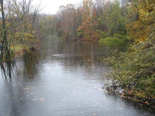
Assonet River Description
The Assonet River is a major tributary of the Taunton River in southeastern Massachusetts in the United States. The mouth of the river forms approximately between Winslow Point in Assonet, Massachusetts and Conspiracy Island in Berkley, Massachusetts. At its mouth, the Assonet River also forms Hathaway Cove in Assonet. From this general location, it flows northeast between Assonet and Berkley, eventually forming Shepherd's Cove in Assonet on its eastern side. From here, the river turns more northward and forms the beautiful Assonet Bay, a large inland body of water. Assonet Bay branches in several directions: To the north is the mouth of Stacy's Creek, which runs north and also separates Assonet from Berkley. To the south, it forms Payne Cove. The south end of Payne Cove turns into a smaller river which runs into Mill Pond. Terry Brook picks up on the east side of Mill Pond. To the east, Assonet Bay continues as the next portion of the Assonet River. From this point, the river runs under Route 24 and into Assonet Village, where it becomes much narrower and runs through the center of the Village. This portion of the river essentially stops west of Mill Street in Assonet, where a dam has created a waterfall. On top of the dam, the river continues to parallel Mill Street until Forge Road, where another dam divides the river. This dam forms Forge Pond. On the northwest of Forge Pond is Quaker Brook. To the northeast, the Assonet River continues until the tri-border of Assonet, Berkley, and Lakeville. At this point, it becomes Cedar Swamp River.