Monponsett Ponds Fishing Spot
- County: Plymouth - Halifax MA
- Acreage: 528
- Public Fishing: Yes
- Mean Depth: 7'
- Max Depth: 13'
- Elevation: 51'
- Website: http://www.mass.gov/eea/docs/dfg/dfw/habitat/maps-ponds/dfwmonpo.pdf
- Last Modified By: samf on 07/07/14 08:53 AM
- Ask about Monponsett Ponds in our Fishing Forums
Photos
Fish Species
Comments
-
This is indeed a tough shore fishing spot, limited access and very shallow water on the West Lake as well. Ive caught quite a few Panfish on the rocky shoreline next to the road on the East Lake though, Crappie; Perch; Bluegill etc. Also a few small Largemouth and Spotted Bass here and there. The West Lake the past 2 years has had a SERIOUS algae bloom problem, to the point where its been shut down to swimmers, fisherman, and boaters. The East Lake is your best bet on a boat and from shore for hooking up.
-
This is a lousy pond for shore fishing. The only real access is over by the boat launch which is quite noisy due to traffic. Also the strong wave currents generated by the water skiers and motor boats are a bit of a nuisance.
Bottom line: It might be an OK pond if you have a boat. Otherwise don't waste your time.
Monponsett Ponds Baits and Tackle
Hard Baits Check Prices
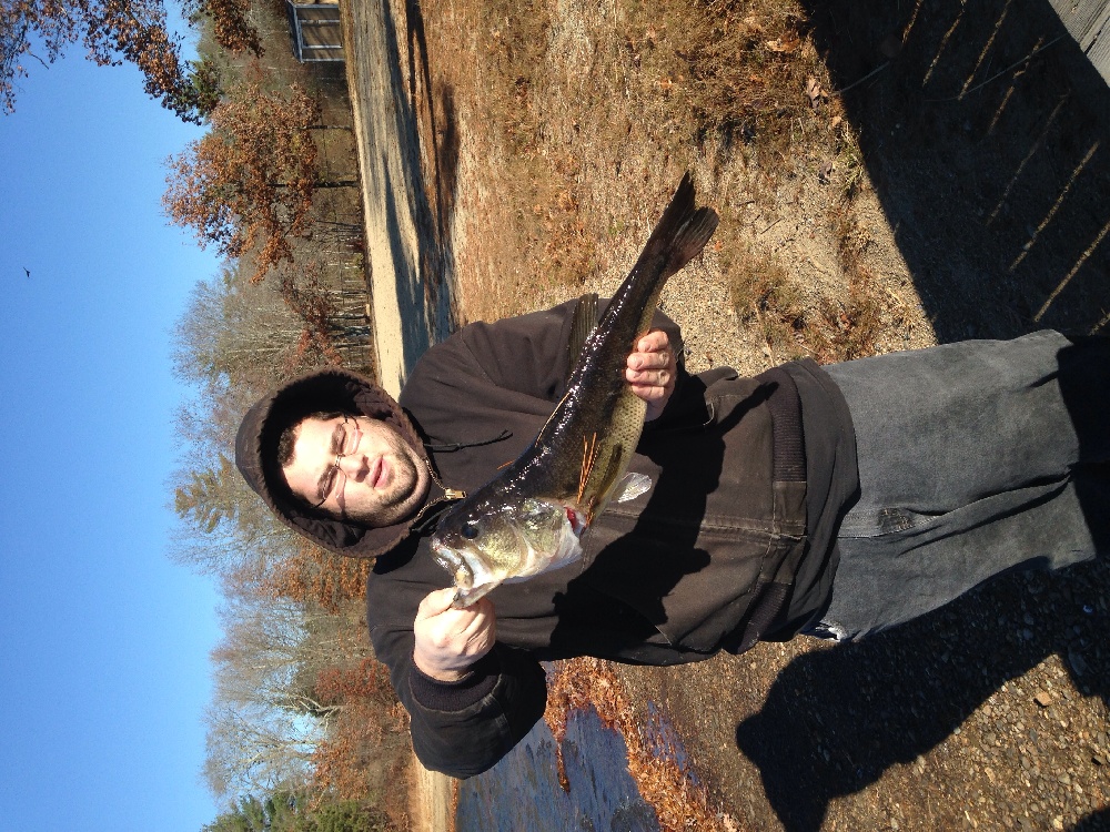
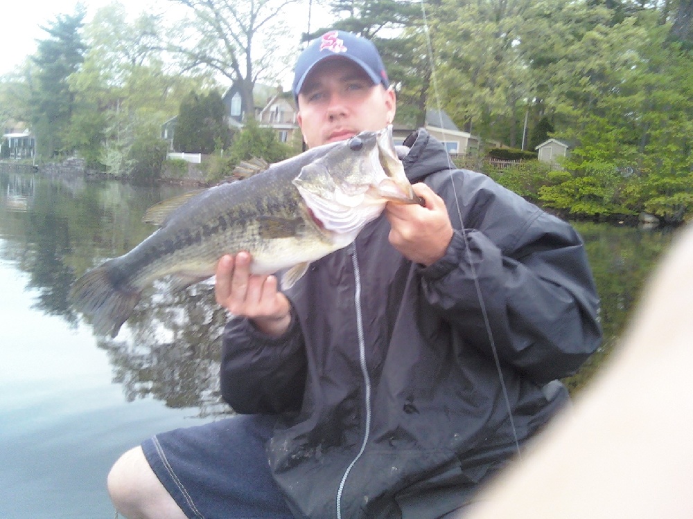
- 2 keepers: 2lber, and 1lb 5oz
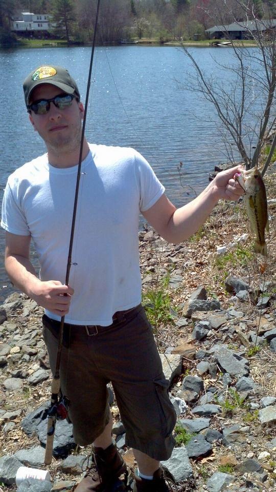
2 shorts, and 2 lost - A mix of 6" to 1lb
Lure (Other) Check Prices
- Black senko worm
- Black senko rubber worm
Crankbait Check Prices
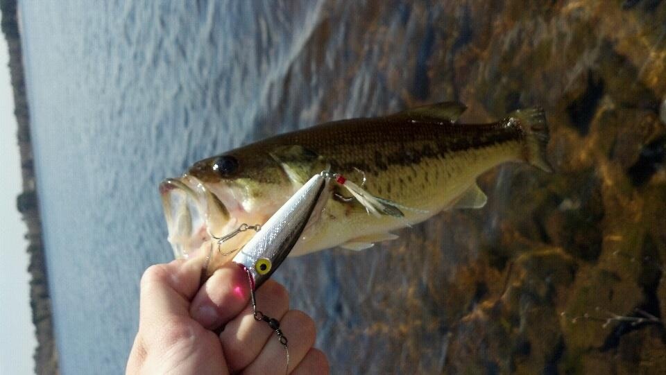
- Strike King Bitzy Minnow
- Rapala Jerkbait - black and silver
- sexy shad lipless crank
- Rapala 7-11 foot crankbait. Not sure what the pattern is called
- slow retrieve
- using an excalibur rayburn red crankbait
- Hard Plastic Frog
Topwater Bait Check Prices
- pulled a hula popper from shore into the water, got him 2 feet from shore.
- throwing floating minnow under the docks along shore, pulling crappies and pickerel, 1 good size bass, 2+lbs but he got off the hook.
Lipless Bait Check Prices
Spinnerbait / Buzzbait Check Prices
- white spinner white grub trailer
- Strike King Black and Blue Spinner bait.
In-Line Spinner Check Prices
- Mepps #1 Gold with Brown Foxtail
Hard Swimbait Check Prices
Plastic Swimbait Check Prices
- Small swim bait. Also my 12 year old son caught one on a shiner. From this and previous trips, seen some close to a pound in here. Pretty decent size for a perch.
Worm Check Prices
- 6" FINESS WORM WEIGHTLESS RED W/ RED FLAKES
TEXAS RIGGED 6" BLACK BERKLEY POWER WORM 3/8 OZ TUNGSTEN WEIGHT W/ 40MM GLASS BEAD - Green Bass Pro Tournament 6 in worms.
- Watermelon Green Bass Pro Jerk Bait 6 in worms
- pumpkinseed worm wacky style
Monponsett Ponds Description
Monponsett Ponds is a relatively large system (total area 528 acres) consisting of two basins: east and west. Route 58 runs between the two basins, which are connected by a small culvert at their southern ends. The eastern basin is 246 acres; the western basin is 282 acres. Both basins are infertile, transparent to about six feet, have an average depth of seven feet and a maximum depth of 13 feet. The bottom is a mixture of sand and rubble. Emergent vegetation covers approximately 20% of the surface area of both basins. The eastern basin has three and a half miles of shoreline, about a third of which is developed with year round homes. The western basin has a little over four miles of shoreline, about a fifth of which has been lost to residential development. East Monponsett Pond is used to supplement he City of Brockton's Silver Lake Water supply during the winter months and West Monponsett Pond drains into Stump Brook, a tributary of the Satucket River. Access: Public access to West Monponsett Pond is a state Public Access Board boat ramp located off Route 58 (Monponsett Street). There is a large unpaved parking area for about 20 vehicles and a boat ramp with concrete pads. Access for smaller boats to East Monponsett Pond can be made underneath Route 58 through a low culvert. There are also two access points for town residents only: the access to East Monponsett is off Holmes Street (Route 36) and to West Monponsett Pond the town access is off Lingan Street at the end of Fourth Avenue. The fish population of East Monponsett Pond was most recently sampled in August of 2001. Bluegill, white perch, yellow perch, pumpkinseed and largemouth bass were common, chain pickerel and golden shiner were also found. The fish populations of West Monponsett Pond were most recently sampled in June of 1990. Ten species were observed in the western basin: white perch, yellow perch, pumpkinseed, bluegill, largemouth bass, black crappie, golden shiner, brown bullhead, chain pickerel and American eel. White sucker were also observed in West Monponsett Pond.