North Pond Fishing Spot
- County: Middlesex - Hopkinton MA
- Acreage: 234
- Mean Depth: 8'
- Max Depth: 20'
- Elevation: 225'
- Bathymetry Map: View North Pond Bathymetry Map
- Last Modified By: vinny60 on 08/19/09 06:26 PM
- Ask about North Pond in our Fishing Forums
Photos
Fish Species
Comments
-
Boats can access this by launching from the "Loui B's" Boat Ramp across the street. Bang a right off the ramp and duck under the road through the tunnel.
North Pond Baits and Tackle
Spinnerbait / Buzzbait Check Prices
- White 3/8 Strike King
Worm Check Prices
- senko
Lizard Check Prices
- 1/4 oz c rig watermelon 5in lizard
- 1/4 oz c rig lizard
North Pond Description
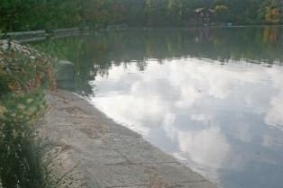
Car top launch on West Main Street.
This 234-acre, fertile great pond, also known as Lake Maspenock, is located about three-quarters of a mile west of Route 495 in Hopkinton. Maximum depth is 20 feet; average depth about eight feet. The bottom is composed primarily of muck and mud, but there is plenty of scattered structure in the form of rocks, rubble and the occasional fallen tree. The shorelines are heavily developed with year round homes. Aquatic vegetation is common to abundant, and appears to be increasing steadily. A study is underway to reduce the problem (accelerated eutrophication) by installing local sewerage. Boat and shore-fishing access is limited primarily to an undeveloped site owned by the Public Access Board and located on the south side of West Main Street between the northern causeways. There is parking space for approximately eight vehicles here, but launching is limited by current conditions to car top boats and canoes. This site is expected to be improved in the future. Historically, and particularly during the ice fishing season, access and limited parking has also been available at the base of the southernmost “island” (Sandy Island) which juts from the eastern shore near the center of the pond. Fish Populations: largemouth bass, chain pickerel, white perch, yellow perch, yellow bullhead, brown bullhead, pumpkinseed, bluegill, black crappie, white catfish and golden shiner. White perch and white catfish dominated the sample.