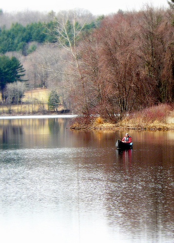
Quaboag Pond Fishing Spot
- Acreage: 541
- Public Fishing: Yes
- Mean Depth: 6'
- Max Depth: 12'
- Elevation: 596'
- Bathymetry Map: View Quaboag Pond Bathymetry Map
- Website: http://www.mass.gov/eea/docs/dfg/dfw/habitat/maps-ponds/dfwquabo.pdf
- Last Modified By: samf on 07/22/13 12:17 PM
- Ask about Quaboag Pond in our Fishing Forums
Photos
Fish Species
Quaboag Pond Baits and Tackle
Soft Baits Check Prices
- 1-1/4lber and some 1lbers
- Two 3/4lbers, and 4 shorts
- Surprised I only got one today!
Live Bait (Other) Check Prices
- Big shiners
Other Check Prices
- Big
Dead
Crankbait Check Prices
Topwater Bait Check Prices
Worm Check Prices
- Green Pumpkin Senko-style stick bait, wacky-rigged.
Soft Swimbait Check Prices
- Reaction Innovations Soft swimbait
Bass Jig Check Prices
- 4-1/4lb on a jig
3-3/4lb and 1lb 15oz on senko
two 1lbers on buzzbait - All on a swimjig
My 9.75lb Limit was:
2lbs 11oz
2lbs 2oz
2lbs 1oz
1lb 8oz
1lb 6oz
5 more in the 1-1/4lb to 3/4lb range
Minnow Check Prices
- you play the bait and bobber set up similar to the canal at the cape.I set the bait at about 24-27",sent it up curent and let it pass you reel it back and repeat.
- Minnow. Just below ice and a foot off bottom
- Med Shiners
Wish we had gotten some larger ones
Quaboag Pond Description
This 531-acre pond averages 5.9 feet in depth with a maximum of 12 feet. Aquatic weeds are common along much of the shore. Residential development is moderate with several year-round homes and summer cottages. Half of the northern shoreline is bordered by Shore Road, while the remaining half is clustered with cottages and houses. About 2/3 of the eastern shore is developed, in contrast to the practically undeveloped western shoreline. Boats can be launched at the north end of the pond off Shore Road. There is a paved launching ramp and parking space for 50 cars. Fishing, boating, and swimming are all popular. Fish Populations: Gamefish present include largemouth bass, chain pickerel, and northern pike. Seven species of panfish are present including white perch, yellow perch, black crappie, bluegills, pumpkinseeds, and redbreast sunfish. Bullheads, both yellow and brown, white suckers, golden shiners, and lake chubsuckers also inhabit the pond. Northern pike have been stocked here regularly.
Fishing interest at Quaboag Pond is intense, particularly through the winter when anglers are in pursuit of northern pike. There are also good catches of largemouth bass, chain pickerel, white perch, yellow perch, and black crappie to be made. For those interested in summer fishing, Quaboag Pond has some of the best potential for bullheads around.
Quaboag Pond is a 537-acre pond located near the East Brookfield and Brookfield, Massachusetts. The pond lies about two miles south of state Route 9 as it passes through East Brookfield. Quaboag Pond was once named Podunk Pond.