A-1/stump Pond Fishing Spot
- County: Worcester - Westbourough, MA
- Acreage: 325
- Public Fishing: Yes
- Mean Depth: 3'
- Max Depth: 15'
- Website: http://www.mass.gov/eea/docs/dfg/dfw/habitat/maps-ponds/dfwa1st.pdf
- Last Modified By: samf on 08/12/13 11:17 PM
- Ask about A-1/stump Pond in our Fishing Forums
Photos
Fish Species
Comments
-
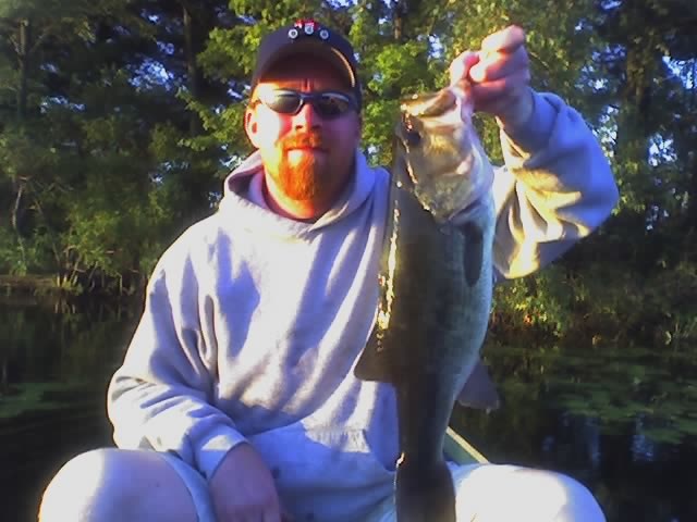
Definitely big bass in this pond have caught one 8-9 pounder this summer and a bunch of average size bass.
-
I saw a couple of guys in there in a 17 ft Nitro fishing last year... they were navigating using their trolling motor - never left the East portion of the pond.... Bass Hound would be easy....
-
Can you get a bass hound with trolling motor in there?
-
My absolute favorite. Some days can be a non-stop catchathon and best pull for me has been a 7 from that water. If in a yak or canoe, please be careful and have pfd. We capsized in there from one of the many hidden stumps (and we go all the time). It's a monster in there between weeds and point stumps! But a true must go to spots! I am going to write about it for the hotspots section of the new EZ Angler site.
-
You can Wmc, though I'd not recommend it..it is called stump pond for a reason..after the initial open/deeper put in it is literally littered with stumps
-
Can I get a 16ft bass tracker in here.
-
I've fished it through the ice hooked one years ago that we couldn't fit through the hole some big ones in there but yes over fished.But like the above mentioned damn construction and having fence up left most of the big boats off the last few years hopefully the bass have caught their breath and venture out a little further from the vast cover and structure that they hide so well in!
-
Those electro shocking rumors are a bunch of b.s.
There is a guy on NEF who talked to the head guy at MA wildlife who confirmed that the biggest bass ever shocked up in MA was like 8lbs. Those rumors pop up every year -
There was some talk last year about that electroshock thingie producing 2 fish over 10 pounds. That place will probably get hammered this year
-
I do agree on that. If A-1 can produce 13lbs then she can deff produce other trophys. 30 min drive is nothing so i'd recommend going.
A-1/stump Pond Baits and Tackle
Casting & Trolling Spoon;22 Check Prices
- silver spoon
- 3 fish limit @ 3.37lbs
lots of 1lbers
Streamer Check Prices
- Chart/White clouser
Other Check Prices
- usually rubber worms
Crankbait Check Prices
- Rapala Original F-7 - Minnow
- perch rapala - was surprised to get nothing on a soft worm.
- perch rapala
- rapal
- rapala
- Strike King Pro Series 4S - Sexy Shad
- 1 on a shinner 1 on a senko and the big guy on a huge 7 inch crank bait while trolling
- KVD Rattling Square Bill
- Bait ball. From live target
- Baitball. Live target
- Bluegill Segmented Swimbait
Topwater Bait Check Prices
- Zmkanpop frog elite w/ chart belly rigged w/ a 4/0 Gami
- Frog themed Hedon mini torpedo
- Jitterbug
Stick Bait Check Prices
- All morning chain pickerel were hitting my plastic lures, but not taking any hooks. One did manage to bite my power worm in just the right spot however, and gave a nice fight. After that I threw a newly acquired Rapala Husky Jerk around, and got an even nicer pickerel in return! If anyone wants that lure, it's still there, stuck in a tree branch.
Lipless Bait Check Prices
- Live Target Golden Shiner Vibration Trap Lipless Crankbait
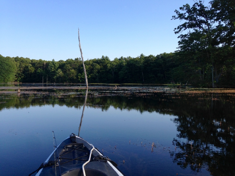
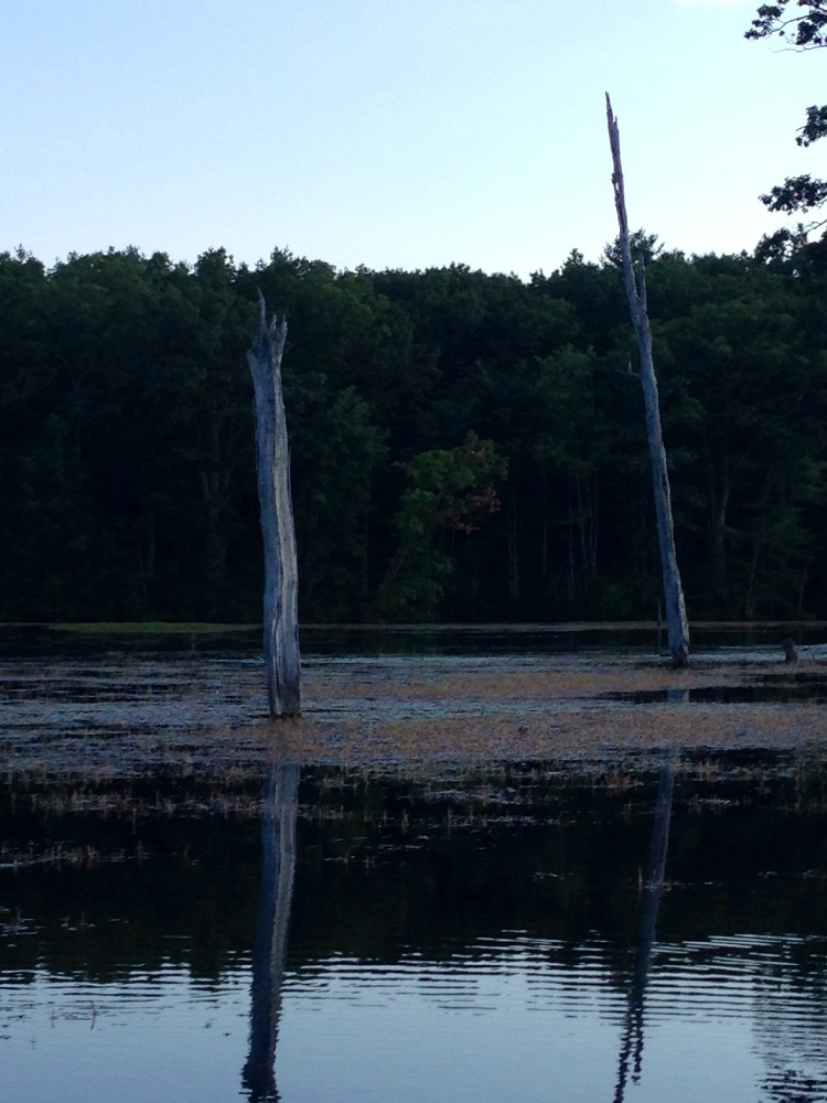
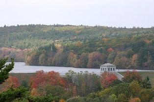
A-1/stump Pond Description
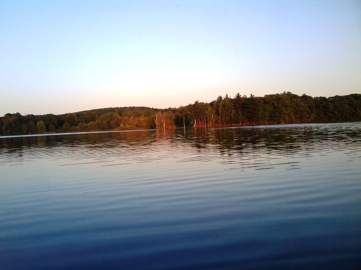
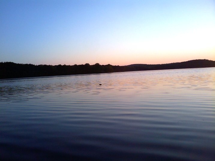
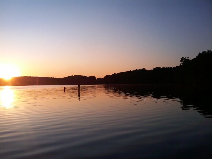
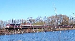
A-1 Site is the headwaters of the Assabet River. It was created by building the George H. Nichols Dam. It is a 325-Acre shallow lake. When it was created, trees were not removed before flooding. Over the years they have fallen creating a maze of fallen trees and stumps. It is a wonderful fishing spot. Boats are allowed, but the prudent captain sticks to the small section that is tree free or else carefully navigates the rest of the lake. If paddling, it is best to go slow as hitting submerged logs could capsize the unsuspecting voyageur. I spotted Osprey nests with young in some of the few remaining standing trees. A Railroad runs parallel to one side of the lake. This 325 acre warmwater pond, sometimes called "Stump Pond,” is located a half mile southwest of Westboro center off Mill Road. Here an informal asphalt ramp is suitable for the launching of canoes and small boats. There is ample parking on both sides of the road for approximately 20 vehicles. Characterized by brown, fertile water, this pond has an average depth of about three feet with a maximum of 15 feet. Listed in order of abundance, the sample was comprised of golden shiners, brown bullhead, yellow perch, pumpkinseed, largemouth bass, black crappie, white sucker and white catfish. Sampling was extremely difficult because of the dark water color, excessive brush and tree stumps. Tiger muskies and northern pike have been stocked here dating back to 1988, and will continue to be stocked when available. Fishing: For the fisherman looking for a unique and challenging pond for bass fishing, the A-1 Site is it. In fact, in terms of both quantity and average size, this is undoubtedly one of the most productive largemouth bass waters in the state. Fish in the 3 to 5 pound range are common. As you would expect, fishing pressure is heavy throughout the year.