Hopedale Pond Fishing Spot
- Acreage: 95
- Public Fishing: Yes
- Mean Depth: 5'
- Bathymetry Map: View Hopedale Pond Bathymetry Map
- Website: http://www.mass.gov/dfwele/dfw/habitat/maps/ponds/pdf/dfwhope.pdf
- Last Modified By: carpmaster on 08/15/09 07:53 PM
- Ask about Hopedale Pond in our Fishing Forums
Photos
Fish Species
Comments
-
Been able to pull a lot of Crappie out over the past few weeks. Will update as I verify more.
Hopedale Pond Baits and Tackle
Soft Baits Check Prices
- DropShot - Bass Pro XPS hand poured worm
- Dropshot - XPS Hand Poured Worm
- Drop Shot
Other Check Prices
- Canned sweet corn, White bread work well here as well as all manner of dough baits and boilies.
- Again corn, white bread work well..I make much of my own dough bait or order some mixes through Wacker Baits
- Same as the other locations. Maple peas worked well for me here, corn, bread, boilies of various flavors.
- scented maize and corn
- Bait for carp: (which are the only fish I am coun ting for here)
Chum the night before with a mix of Maize and oat/bran/grits method/ground bait
Hook bait was maize on a hair with tutty-fruity or molasses glug, or maize or corn-pops on the hook with a oat/bran/grits pack bait
Bait for sunnies/bluegills/etc:
Meal worms, canned corn, bread
Many were caught as part of the event but I did not keep a tally. - Maize has been my bait of choice, followed closely by maple peas and an oat based pack bait.
Molasses and maple have been strong producing flavors for me this early on..latter this will change to more fruit and maybe even a fish/blood as the water warms. - Feed corn is a staple for our trips lately, though it was clearly out performed number wise by a cat food/grits/cream corn mix method-pack bait.
The biggest fish of the session however was taken along the far left margins, with 2 pieces of feed corn on a sliding hair rig, with a size 6 hook. - Maple peas were on the menu today. I chummed maize/peas/boilies/strawberry corn
- We have been using primarily feed corn, soaked for at least 24 hours then boiled for 1 hour till it is a firm but chewable texture. Molasses and fishy flavors have been the producing choices.
We have also been using a grits based pack bait, with some results.
Pre-feeding will produce better results typically - Again Feed corn is a big success here. Also shrimp/fishy flavored boilies have produced well.
- This was our trial run weekend for a new line of boilies my friends and I have been working on from the Blackstone Carp videos. Dat Food Boilies ( we used 3 types Shrimplies(shrimp), Gold(pineapple)and Pop-ups). I won't give the recipe on these as it has taken me quite some time to put a truly good boilie together. I will, on request, give out some more basic boilie recipes to get people started though.
Also Feed corn was on the menu and did produce a fish or two. - Feed corn and Dat food boilies have become my baits of choice as well as staples in any trip.
Molasses and fishy flavors seem to still work well, though strawberry has been more and more effective. - Feed corn and Dat food are always on the menu now. Maple peas have made their way back as well. We had a batch of Anise and fruit ( see the tutorial on bait in the forums or at www.blackstonecarp.com) and some of the Dat food dough un boiled. Dat food seemed to be the bait of choice with maples coming in just behind.
- Dat food, feed corn were used. Dat food produced some but the real hitter of the day was a grits based pack bait ( see the bait tutorial in the forums or on www.blackstonecarp.com)
- Our bucket contained once again
feed corn, maple peas, dat food and chick peas.
Sadly on this outing nothing really produced with a few Crucian carp grabbing anything they could. - Dat Food Obsession
Dat Food Tuttie
Dat Food Omega
Chick peas
Pescaviva sweet corn - Many things keep coming along for the ride. Sweet corn flavored various ways,
Feed corn heavy on molasses,
Dat food milk based with heavy seed/forage - power bait off bottom
- power bait
- Sweet corn
Crankbait Check Prices
- Rapala Original F-7 - Minnow
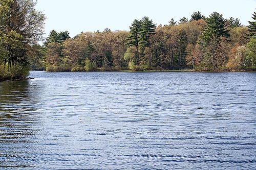
Hopedale Pond Description
This fertile 95-acre warm water pond is located about one mile northwest of the junctions of Routes 140 and 16. There are several good access points, but a gravel ramp provided by the Town of Hopedale and located off Park Street is an excellent place to start. Watercolor here tends to be rather brown. The depth averages about five feet pretty much throughout the pond. The Town of Hopedale owns the entire eastern shore and northern two-thirds of the western shore. Many trails and footpaths on the eastern shore provide excellent access for shore fishing. Fish Populations: yellow perch, bluegills, pumpkinseeds, golden shiners, chain pickerel, yellow bullheads, largemouth bass, black crappie, brown bullheads and American eel. White catfish are also known to be present.
There is extensive aquatic weed growth at Hopedale Pond, a potentially troublesome problem for the fisherman during the mid-summer. Bass fishing should be easier and probably more productive during the spring and into early summer before the weeds take over. Ice fishing for chain pickerel should be productive, as well as overall fishing for panfish species. Large white catfish are also caught here regularly.