West River Fishing Spot
- County: Worcester - Uxbridge
- Website: http://www.mass.gov/dfwele/dfw/recreation/fishing/trout/tags_n_trout.htm
- Last Modified By: carpmaster on 02/16/10 12:47 PM
- Ask about West River in our Fishing Forums
Photos
Fish Species
West River Baits and Tackle
Other Check Prices
- Canned sweet corn, White bread work well here as well as all manner of dough baits and boilies.
- Again corn, white bread work well..I make much of my own dough bait or order some mixes through Wacker Baits
- Same as the other locations. Maple peas worked well for me here, corn, bread, boilies of various flavors.
- scented maize and corn
- Bait for carp: (which are the only fish I am coun ting for here)
Chum the night before with a mix of Maize and oat/bran/grits method/ground bait
Hook bait was maize on a hair with tutty-fruity or molasses glug, or maize or corn-pops on the hook with a oat/bran/grits pack bait
Bait for sunnies/bluegills/etc:
Meal worms, canned corn, bread
Many were caught as part of the event but I did not keep a tally. - Maize has been my bait of choice, followed closely by maple peas and an oat based pack bait.
Molasses and maple have been strong producing flavors for me this early on..latter this will change to more fruit and maybe even a fish/blood as the water warms. - Feed corn is a staple for our trips lately, though it was clearly out performed number wise by a cat food/grits/cream corn mix method-pack bait.
The biggest fish of the session however was taken along the far left margins, with 2 pieces of feed corn on a sliding hair rig, with a size 6 hook. - Maple peas were on the menu today. I chummed maize/peas/boilies/strawberry corn
- We have been using primarily feed corn, soaked for at least 24 hours then boiled for 1 hour till it is a firm but chewable texture. Molasses and fishy flavors have been the producing choices.
We have also been using a grits based pack bait, with some results.
Pre-feeding will produce better results typically - Again Feed corn is a big success here. Also shrimp/fishy flavored boilies have produced well.
- This was our trial run weekend for a new line of boilies my friends and I have been working on from the Blackstone Carp videos. Dat Food Boilies ( we used 3 types Shrimplies(shrimp), Gold(pineapple)and Pop-ups). I won't give the recipe on these as it has taken me quite some time to put a truly good boilie together. I will, on request, give out some more basic boilie recipes to get people started though.
Also Feed corn was on the menu and did produce a fish or two. - Again the Dat food boilie line really worked well here. Shrimplies(shrimp) and gold( pineapple) performed above my expectations. Feed corn was of course also on the menu and produced a few good runs.
- Feed corn and Dat food boilies have become my baits of choice as well as staples in any trip.
Molasses and fishy flavors seem to still work well, though strawberry has been more and more effective. - Feed corn and Dat food are always on the menu now. Maple peas have made their way back as well. We had a batch of Anise and fruit ( see the tutorial on bait in the forums or at www.blackstonecarp.com) and some of the Dat food dough un boiled. Dat food seemed to be the bait of choice with maples coming in just behind.
- Dat food, feed corn were used. Dat food produced some but the real hitter of the day was a grits based pack bait ( see the bait tutorial in the forums or on www.blackstonecarp.com)
- Our bucket contained once again
feed corn, maple peas, dat food and chick peas.
Sadly on this outing nothing really produced with a few Crucian carp grabbing anything they could. - Dat Food Obsession
Dat Food Tuttie
Dat Food Omega
Chick peas
Pescaviva sweet corn - Many things keep coming along for the ride. Sweet corn flavored various ways,
Feed corn heavy on molasses,
Dat food milk based with heavy seed/forage - Sweet corn
Crankbait Check Prices
Hard Swimbait Check Prices
- Shad Rap in Blue/Black color
Plastic Swimbait Check Prices
- BkBl Senko Rigged Wacky
Worm Check Prices
- assorted plastics and spinner bait top water frog
- sweat tater pie
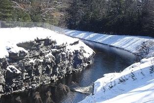
West River Description
The West River in Massachusetts, a tributary of the Blackstone River, originates in the town of Upton, Massachusetts, near the Upton State Forest, crosses into the eastern portion of Northbridge, passes through the eastern portion of Uxbridge where the West Hill Dam provides flood control, and enters into the Blackstone River south of Uxbridge and Wheelockville before the Blackstone enters the state of Rhode Island. The course of the West River in Massachusetts is over ten miles. A Wildlife preserve with fishing, hiking and Recreation trails are found at a federal recreation area created at the West Hill Dam.
The West River has been stocked with tagged trout. If you shall be one of the rare lucky angelrs that's able to land one of them, make sure you call Jeff Leclaire at (508)529-3901.